Friday, August 2, 2019

Top Hiking Trails in Orange County


1. The Coast: hill trails with ocean views and breezes
1.1: Laguna Coast Wilderness (Boat Canyon Dartmoor Trailhead)
1.2: Crystal Cove State Park (Pacific Ridge Trailhead)
1.3: Top of the World (Alta Laguna Park to Aliso Wood and Canyons)
1.4: San Juan Capistrano Hills (Roller Coasters Trail)
1.5: Aliso Summit Trail (Seaview  Park to Aliso Beach)

2. The Coast: trails along the cliffs and/or down to the sands and tide pools
2.1: Crystal Cove State Beach
2.2: Corona Del Mar/Little Corona Del Mar (at low tides)
2.3: Crestcent Bay (North/South/Shaw Cove)
2.4: Newport Back Bay
2.5: Thousand Steps Beach
2.6: La Tour (Victoria Beach)

3. The Wilderness/OCParks/Irvine Convervancy Landmarks:
3.1: Whiting Ranch Wilderness Park
3.2: Limestone Canyon Park
3.3: Chino Hills State Park
3.3: Santiago Oaks Wilderness


4. OC Peaks:
4.1: Saddleback Mountains: Santiago and Mojeska Peaks (via the Joplin and Holy Jim trails)
4.2: Los Pinos Peak (via West Horsethief and Trabuco Canyon trails)


5. Santa Ana Mountains and Cleveland National Forest:
5.1: Sierra Peak (via Pipeline and Coal Canyon)
5.2: Blackstar Canyon Falls (seasonal, winter with lots of rains)
5.3: Falls Canyon/Holy Jim Falls (seasonal, winter with lots of rains)

6. Urban Views: quick conditioning trails
6.1: The hills of Turtle Rock in Irvine
6.2: Peters Canyon Regional Park (back entrance, from Peters Canyon Road)

7. Historic Parks and Botanical Gardens:


Tuesday, September 25, 2018

Whiting Ranch Wilderness, Class of 2018

September 23, 2018


One of favorite trails in Orange County that HikingOC.com offers on a weekend is at Whiting Ranch Wilderness Park.


Most often, it could be a group of 20s, 30s, 40s, or more, but sometimes it could be a small group of five. There are some different levels of speed and endurance in a hike, but when Red Rock Canyon includes in a hike, it is mainly for the new group (beginners, those who don't hike often or haven't been hiking before).


It was a full house at the beginning. After ten minutes into the hike and 30 minutes into the flat trail, the group will be separate out in many subgroups by hiking pace and elevation gain.


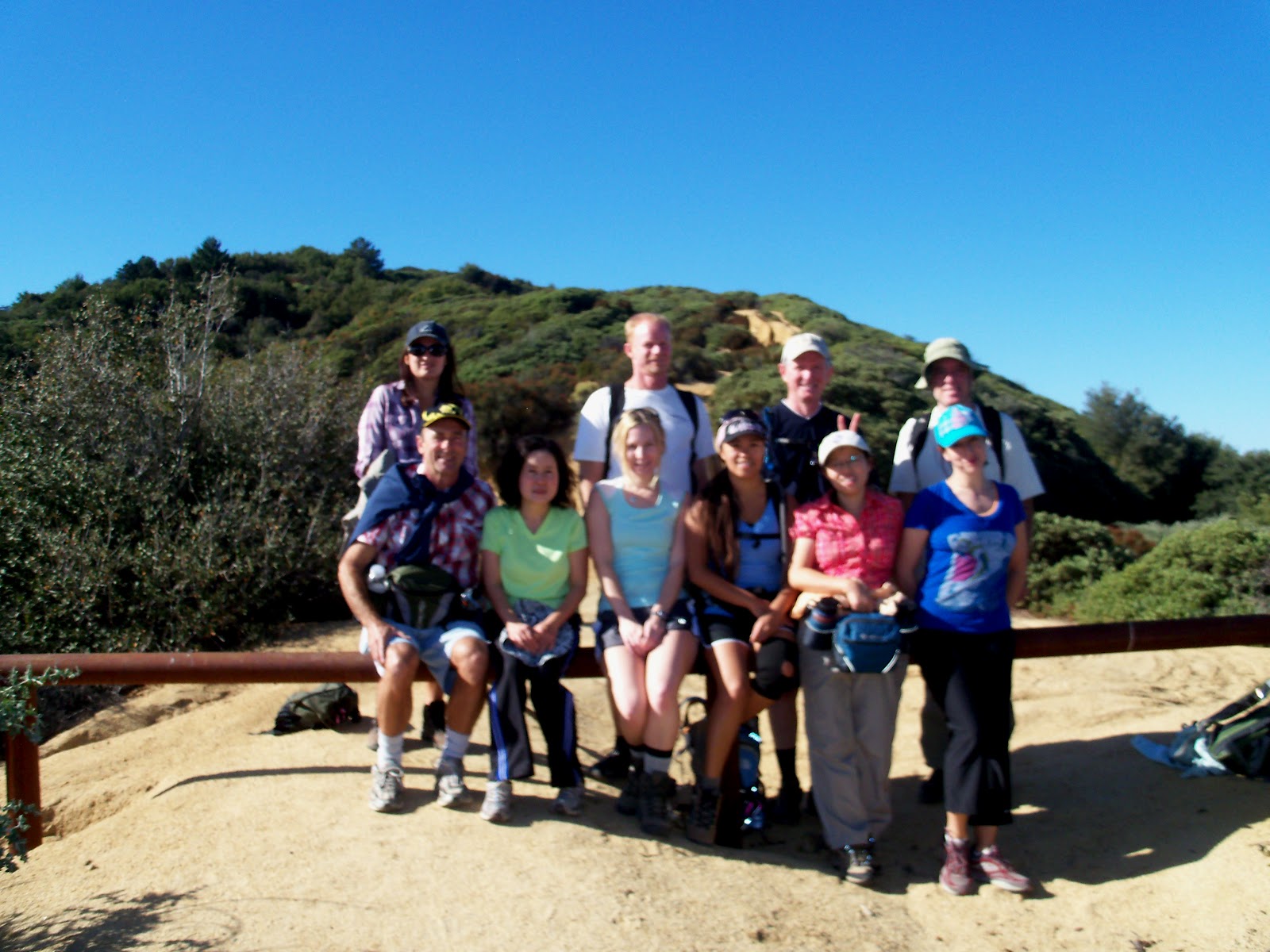
Each week, each month and each year, we will meet different hikers, but most often only some or few will be remaining in the memories from photos. Thanks to the camera and the phone, many sweet memories stay with us and at the moments writing down, it will share to many others. Hope that the beauty of nature and the exercise in fresh air, hiking will not only be good for an individual who joins the hike for the benefits of body and mind, it will also be inspiring those who have not known about this activity to come out and experience for themselves.


It was Winter time somewhere else, but for Whiting Ranch in Orange County, it was Summer time on the trail...


It was August, early morning or late afternoon to get away with the warm Summer heat...


The past Saturday was the second year in the row without planning, we got exact the same hike on the same day offering to new hikers. With the excited to hike a new trail and to get one progressing to higher levels of hiking, it gave a different inspiration to those who have been hiking for so long. It is a group energy and a begin of a journey to friendships in an activity.


 For more details and photos, check here https://www.meetup.com/HikingOC/events/254693979/

Not too often, but when you had hiking buddies joined, then it was bonding time after the hike was good food to cool down. We got to get in Boiling Point in Irvine, the busy place anytime of a day. It was good for an early hike and came there at the opening time. 


Friday, September 21, 2018

HikingOC Annual Eastern Sierra Trip: Devil's Postpile National Monument, Thousand Island Lake and a Group Gourmet Dinner

Mammoth Lakes in the Nevada Eastern Sierra, a favorite destination with so many beautiful trails for hikers and outdoor lovers. HikingOC.com has at least a trip per year in this area.

Labor Day Weekend last year-September, 2017 after few attempts from previous years, we finally got a chance to hike and complete the Thousand Island Lake in a good weather and a nice group of hikers.


Starting before sunrise leaving town, the drive is long (about 350 miles/6 hours one way from Irvine), but it is best driving early morning or late evening when no traffic.


Beautiful sky show before sunrise by Burbank hills. There was a fire going on that added more dramatic to the clouds http://www.latimes.com/local/lanow/la-me-ln-brush-fire-verdugo-20170901-story.html#


When the sun was out, we were looking ahead of the high 90 s degrees up to three digits temperatures in Southern California.  


To beat the heat and have a nice cool air in Mammoth Lakes, we visited and got short hikes to a special landmark: Devil's Postpile and Rainbow Falls. 


For more details and photos, check out from the link:  
https://www.meetup.com/HikingOC/photos/28139622/464716002/


The best part of the trip was a group gourmet dinner as a family at the campground (sometimes we would have it at a cabin, a lodge or a house). There were several dishes and HikingOC.com often had it as a "buffet" style that would fit anyone (including vegetarian and vegan). 


 For more details and photos of the trip: https://www.meetup.com/HikingOC/photos/28139577/464297580/


Tuesday, April 3, 2012

Day Hikes of Grand Canyon South Rim Trails


In our previous article,"Grand Canyon Three Day Trip with HikingOC", we mentioned about the scenic and challenging hiking trails of the South Rim that take us into the inner canyons. The second day of our three day trip is our main hiking day where we will explore the famous trails of Grand Canyon (GC)--South Kaibab and Bright Angel trails. Since our group has different hiking levels, we will gather in four subgroups: beginning, intermediate, intermediate-plus and advance.

You can check here to find out your hiking level: What is the difference between skill levels?

If you are new to the meetup, please make sure that you join the hosting organizers for at least one hike prior to the trip to determine which group level you should belong to. During the trip, we recommend that you stay with the group in which you have been trained to hike with Lyrid Meteor Shower + Hiking Grand Canyon South Rim (All Levels-Camping/Lodging)
Hiking the Grand Canyon is a great experience. However, without proper training and preparation, sad news likes this can happen: Newlywed dies after Grand Canyon fall

We highly recommend that you hike with a group to the inner canyon unless you'd like to take time strolling around the park. Except for the beginning and intermediate groups, we all start together at the South Kaibab trailhead, but each group will have a different returning point. The advance group will hike the loop after descending the South Kaibab trail and starting to hike up the Bright Angel trail from the river at elevation 2480ft (around 10AM to noon time, it is the hottest time of the day in the canyon) while other groups start from the top of this trailhead at elevation 6860ft around 9AM. The intermediate-plus group will meet up with the advance group at the midpoint of the uphill trail and hike up together.

Here are approximate distance, elevation gain/loss, and total hiking time for each group:
1. Advance group: 17-20 miles, has about 4400-5000ft (gain/loss). Duration:  ~ 7-10 hours
2. Intermediate-plus group: 12.6-15.6 miles, has about 4500-5000ft (gain/loss). Duration: ~ 7-10 hours
3. Intermediate group: 6-9.2 miles, has about 2300-3300ft (gain/loss). Duration: ~ 6-8 hours
4. Beginning group: 3-5 miles, has about 1000ft (gain/loss). Duration: ~ 3-5 hours

Prior to the hike, at the campsites, we will discuss and confirm our hiking plan with other members and organizers. We start our hikes immediately after viewing the Meteor Shower in the early morning.

For both the intermediate plus and the advance groups, they must catch the first shuttle bus going to the South Kaibab trailhead at 6AM (leaving the visitor center); this is optional for the beginners and the intermediate groups - meeting time for these two groups is 9AM at the Bright Angel trailhead.
Since the shuttle bus leave on the hour in the early morning, it is critical to start on time. If we miss the shuttle bus, we will be delaying our hike by one hour and the hike up is brutal in the heat of the day. Page 9 of spring guide has a shuttle map for the route from the visitor center to the South Kaibab trailhead: Grand Canyon the Guide Spring 2012

After getting off the shuttle, we will have to walk 0.8 miles to get to the trailhead. A cautious note to those who haven't hiked the South Kaibab trail before, it is very steep down hill.
The South Kaibab trailhead's elevation is 7260ft above sea level (Orange County is at sea level). The trail is on the ridge line and starts with series switchbacks. Prepare yourself for the change of elevation if you have altitude sickness. Also prepare for a desert climate--dry, cold morning and hot during the day. There will not be a water filling station until we get to the campground (adding 1 mile round trip) or after 5 miles up to Indian Garden on the Bright Angel trail. There are no shades on the entire trail. You should pace yourself as this is an "upside down" hike. The route from the trailhead to the river is 6.5 miles down hill with 4800ft elevation loss. The first highlight of the trail is Cedar Ridge at about 1.5 miles mark--a loss of 1150ft from the start of the trail. This is the turning point if you don't plan on hiking the entire trail. The advance group continues on to the next highlight, Skeleton Point (another 1.5 miles and a loss of 900ft); then to the next landmark, Tiffoff (another 1.4 miles and 800ft loss), this is the last segment before getting to the river which is 2.1 miles and another 1500ft drop. Estimate hiking time is about 3-5 hours to complete this route.

Here are details of the trail: the South Kaibab Trail  and the South Kaibab Trail Map
While the advance group continues hiking to the river on the South Kaibab trail, the other groups returning from the trail will take the shuttle bus back to the Bright Angel trailhead and meet the intermediate level group at 9AM.
Bright Angel trailhead is at elevation 6860ft above sea level, a bit lower than the South Kaibab trail. This is the most crowded hiking trail of the South Rim. Views from this trail follow the head of the canyon--the massive cliffs, and a bit shadier trail with natural water sources and there is more plant life and animal life along the trail than on the South Kaibab trail. These features make this trail appealing to those interested in geology and in viewing wildlife. There are water refill options at Mile-and-a-Half Resthouse* (1.6 miles, descent 1131ft); Three-Mile Resthouse** (another 1.5 miles with almost 1000ft loss) and at Indian Garden (adding 1.7 miles and 950ft loss). The beginners and the intermediate groups can pick the turning point at (*), (**) or earlier at your comfortable limit. Round trip for the route to (*) is 3.2 miles steep both down and up hills or (**) is 6.2 miles. Upon coming back, these groups can take the shuttle to Yavapai Point and hike a little bit more to see the Colorado river and Phantom Ranch.

The intermediate-plus group can go on to the Indian Garden and may optionally hike another 1.5 miles to the Plateau Point looking down the Colorado River. It is approximate 3-6 hours to get to Indian Garden for those who are interested in Plateau Point optional hike. If we coordinate our pace well, we will meet up with the advance hikers at Indian Garden rest stop, refill water and complete our hike up hill together (4.8 miles, about 3100ft gain). This is detailed information on the Bright Angel Trail and the Bright Angel Trail Map 
If we have completed our planned hikes for the day before 5 PM, we can ride a shuttle bus to the scenic route, Hermit Road. The sunset view here is both relaxing and breath-taking. We can choose either Hopi Point, the one that attracts the crowds and buses, or the quieter, Mohave Point, to view the sunset and see the dynamic views of the canyon.

Everyone will probably feel tired because it has been a really long day (3AM to 7PM), but we also feel great that we hiked the South Rim trails. After completing all the day's activities, we will have a group dinner, then a (non-group) shower before resting by the campfire. Happy time to all!

Here are couple more maps of the South Rim trails:
1. Grand Canyon South Rim Topo Map
2. Grand Canyon South Rim Trails Map


Tuesday, March 27, 2012

Grand Canyon Three Day Trip with HikingOC

Photo by Bob Pasadena
The HikingOC Grand Canyon trip features sightseeing and an option hiking with one of our groups or following your own custom itinerary.

1. Sightseeing: drive or take a shuttle on the scenic roads: Desert View Drive and Hermit Road (spring guide page 7)
http://www.nps.gov/grca/planyourvisit/upload/desert-view.pdf 

2. Meteor shower viewing: peak time on earth day midnight April 21 to dawn April 22. http://stardate.org/nightsky/meteors

3. Hiking Trails: Bright Angel trail, Yavapai Point and South Kaibab trail (spring guide pages 8 and 9) http://www.nps.gov/grca/parknews/upload/2012SRspring-guide1202.pdf

(Tentative schedule is subject to change due to weather condition and unexpected emergency)
 
The first day is a travel day; it is almost 500 miles from Orange, CA to Grand Canyon Village, AZ. Travel time by car is approximately 8 hours. Even though it may be a long drive, it is a great chance to spend time with friends and share your excitement of the upcoming journey together. Upon arriving to the Grand Canyon (GC)
, some of us will check in at the Yavapai lodge and some of us will check in at the Mather group campground. We meet up together at the GC visitor center and drive (or ride a shuttle bus) to Desert View Drive for a scenic drive, and later for viewing the sunset.
Photo by Krai
 
Desert View Drive is a scenic route that covers 25 miles of the Arizona Hwy. 64 along the South Rim of GC. Driving across this stretch of land will take us 800 years back in time. Along the scenic viewpoints, we may learn the different ways people found food, water and shelter back then. We also have a chance to experience the "ever-changing seasons of Grand Canyon" that is accompanied by some breath-taking and inspiring landscapes.
We time ourselves for two hours to finish the scenic route before 6:15PM, and then we will head back to Yavapai Point for sunset. Since Yavapai point is known for its spectacular view of the canyons at sunset and usually is less crowded than other viewpoints, we will try our best to make it there before sunset time, which is at 7:04PM. Otherwise, we will stay at Desert View Point to view sunset.

Dinner and night time activities:

Majority of the HikingOC group members will be camping, so we will gather at the campsites for dinner and campfire before calling it a night no later than 10 PM.
Photo by Bob Pasadena
We usually have a great view of the night sky in dark places, away from the city lights, such as the deserts. April is also a peak time of the Lyrid Meteor Shower, so we are up around 3 AM to witness this spectacular night sky full of stars--many shooting stars. As we are busy looking at the stars, it is likely that we won't realize the upcoming sunrise.

Sunrise time is at 5:45AM, so we may have another "show" of the canyon in the early morning light. This begins the second day for the group, which will be divided up  in smaller groups for different hiking levels and interests: 
  • Group 1 does an all day strenuous hike to the river and back for 17 miles round trip.
  • Group 2 and 3 do a moderate hike to the inner canyon from 7-14 miles.
  • Group 4 takes the short easy hikes at different viewpoints on the rim trail.
  • Some of us will like to be on our own, take the shuttle bus and stop by the viewpoints for sightseeing the park.
If you join any of the above hiking groups, we will have detail trails description for each group on another post. You can find it on: http://hikingoc.com/ "Day Hikes of Grand Canyon South Rim Trails". If you are into sightseeing, photography or with family and friends that are not interested in hiking, there are still so much to do on the top of the park. Besides taking pictures at different times of the day, you can stop by Yavapai Geology Museum; attend Geology talk, and Geo-Glimpse to hear the story of how Grand Canyon formed.

Photo by Van Paris
Strolling from point to point around the park is another great thing to do. You can take the shuttle bus to the South Kaibab trailhead and hike a little bit on the rim trail. The trails are listing on page 12 (spring guide), but the other two recommended trailheads are Yavapai Point and Bright Angel trail. From these trailheads with short hikes 1-3 miles combination, you will have a view of the inner canyon, views of the Colorado River and Phantom Ranch.
On the second day, viewing the sunset will be at a viewpoint on Hermit Road, another scenic drive. Hopi Point attracts many visitors, or you can choose a different viewpoint while taking a scenic route on the shuttle bus on the scenic route.

Photo by Dich


Afterwards, we will have another dinner and campfire with the group at the campsites. Tonight is your choice of staying up late. The third day is your optional day. You can wake up late, have breakfast with the group and drive home; you can tour more of the park, or you can get up early and leave. Have a safe drive home!


Tuesday, March 20, 2012

Los Pinos: "The Pines" and Peaks in the Santa Ana Mountains

Have you ever heard of evergreen trees at the coastal mountains in Southern California? It sounds strange, but it is true. Let us take you to the Santa Ana Mountains with peaks at 4000s-5000s feet. Actually there is a peak named after the Pine trees.  "Los Pinos" is Spanish for the pines. There are many pine trees that make up the name for this peak near the northern slope and southern face of the peak just below the summit. 


Photo by Elena
There are numerous ways to hike to Los Pinos Peak. Trabuco Canyon to West Horse Thief trail is the  most popular. Organizer Paul Agnew first introduced Trabuco Canyon trail to our HikingOC group and its members a day after Christmas of 2009. http://www.meetup.com/HikingOC/photos/792131/ The hike was for intermediate hikers with 10 miles distance and  moderate pace. We only hiked the lollipop loop and did not summit any peak.


Our hike goes through chaparral and a varied forest of spruce, Coulter pine, maple, coastal live oaks, sycamores, alders, madrone, and California bay laurel. The trail is a great break from city life offering cool green woods filled with local flora and fauna. 

After the first time, many members in the group asked to have more hikes at this lovely area with scenic and challenging trails. A month later, on Martin Luther King Jr. Day, we went back to the area via a different trailhead and hiked to Los Pinos Peak . We accessed the trailhead via the Ortega Highway 74 to the North Main Divide by the Blue Jay campground.  http://www.meetup.com/HikingOC/photos/804448/ 
That fall, November 2010, we hiked there again for fall foliage with sycamores leave changing color. http://www.meetup.com/HikingOC/photos/1139937/


It's been over a year and we haven't had a chance to go back to this area. The group is training for hiking Grand Canyon next month, so we need a more challenging hike. We are going to explore Trabuco Peak and Horse Thief Peak besides Los Pinos Peak. It is a 15-20 miles hike with about 3500+ft elevation gain. To join us on this event: http://www.meetup.com/HikingOC/events/56765722/


Even though its elevation is only at 4510ft, Los Pinos Peak does rank fifth in the range with 450 feet of prominence (after Santiago Peak, Trabuco Peak, Sitton Peak and Modjeska Peak). It is prominent above Lake Elsinore and San Juan Capistrano and looms above the Ortega Highway. Los Pinos Peak is the southern most 4'er in the range, so the views from this peak are endless with views way down south, of the Pacific Ocean (Catalina and San Clemente Islands), San Jacinto Mountains, San Bernardino Mountains, San Gabriel Mountians and much more of Southern California. 


Trabuco Peak is at 4607ft elevation, the third most prominent peak in the Santa Ana Mountains. The summit lies on the border of Orange and Riverside Counties. The peak is located at the top of Trabuco Canyon and above Temescal Canyon, giving it a commanding view of both canyons. Trabuco or "musket" is a famous name for everything in the area. A story of a soldier who lost his musket when camped a few miles east of the San Juan Capistrano. More details:  http://www.summitpost.org/trabuco-peak/507606  


Horsethief Peak is an unnamed peak. This is a great peak to get away from the crowds that can often be found on Santiago Peak. The views from this peak are just as good as any other peak in the range. Located between Trabuco Peak and Los Pinos Peak, Horsethief Peak is at an elevation of 4,313ft
This link will give more information of different ways accessing these peaks: http://www.summitpost.org/los-pinos-peak/515463


Sunday, March 11, 2012

Point Mugu State Park: Secluded and Gorgeous Campgrounds


Last year, our group: HikingOC was camping and exploring the trails at Point Mugu State Park. We are going to have a similar event this coming April. It'll be a weekend during Spring break, from Friday to Sunday April 13-15, 2012.
If you are interested to join our group for hiking, check here for more information: http://www.meetup.com/HikingOC/events/37866542/


To see photos from last year: http://www.meetup.com/HikingOC/photos/1369261/
Flowers photos by Mai and more on her link : http://photos.think-concept.com/?page_id=288

Point Mugu State Park belongs to our neighbor county: Los Angeles and borders with Ventura county. The park located in the Santa Monica Mountains, features five miles of ocean shoreline of Malibu city that is next to Point Mugu Naval Air Station. Situated 8 miles south of Oxnard, Ventura county and approximately 65 miles northwest of Los Angeles, Malibu not only is a famous community for its warm and sandy beach, it is a home of many Hollywood movie stars and others associated with the entertainment industry.

Point Mugu campground is famous for its "pure heaven on earth", a beautiful place for camping with family and friends. With rocky bluffs, sandy beaches and sand dunes, rugged hills and uplands, two major river canyons, wide grassy valleys dotted with sycamores, oaks and a few native walnuts, this place provides campers, hikers and backpackers both ocean and mountain view. There are more than 70 miles of hiking trails. The beach also features swimming, body surfing and surf fishing. The 13,300-acre park includes the jagged pinnacles of the Boney Mountains State Wilderness Area. Check Reserve America's website for camping information: http://goo.gl/mte2Q

There are few campgrounds at this park, but the most beautiful and convenient campground is Sycamore Canyon. It has flush toilets, hot showers, paved drive-in parking, beautiful ocean views, coastal chaparral, spring flowers, a peaceful wooded canyon and some magnificent sycamores, the sycamores that shade the canyon. Moreover, in the fall this campground is one of the best places in Southern California to observe the arriving monarch butterflies http://www.parks.ca.gov/?page_id=25211


Let's take you back to our trip last April.  We stayed at Sycamore Campground and hiked several trails. The first hike was Sycamore Canyon-Boney Mountain-Deer Canyon
We started from the campground at Big Sycamore trail, to Overlook-Backbone trail, continued to Old Boney trail, to Serrano Canyon trail and backed to Big Sycamore trail to the trailhead. We got almost 14 miles and gained 2000ft elevation. Half of a group went on a smaller loop for a shorter distance taking Big Sycamore trail instead of Serrano Canyon trail loop.

Late afternoon, we met at Ray Miller trailhead, and went on a sunset hike; it was about 6 miles with elevation 800ft. This was a shuttle hike: Ray Miller, La Jolla Canyon to Sycamore Campground. We carpooled out to Ray Miller trailhead at La Jolla Canyon to start. From there hiking up the Backbone trail, then connecting a little bit to Overlook trail, and continuing downhill to the campground. The hike had ocean views a whole way and a beautiful sunset.

Our third hike was Point Mugu Peak and loop to La Jolla Canyon trail. It was a shuttle hike. We drove to Ray Miller trailhead, left few cars, and then carpooled to Chumash trail trailhead. We got another 7 miles with about 1000ft elevation gain.


Lá me đất, lá me (tamarind) và vui buồn những mùa hè tuổi thơ ở nhà ngoại

Bên mình nếu ở quê mới có, hồi nhỏ lúc hè thường về bà ngoại chơi (Vạn Giã, cái xứ 10000 không thật 🤪đúng ra là biển giã hay giã nát thứ gì...